Beyond Acadia: Hiking the far Downeast coast of Maine
Great hiking, superb scenery and solitude abound along Maine’s Bold Coast.
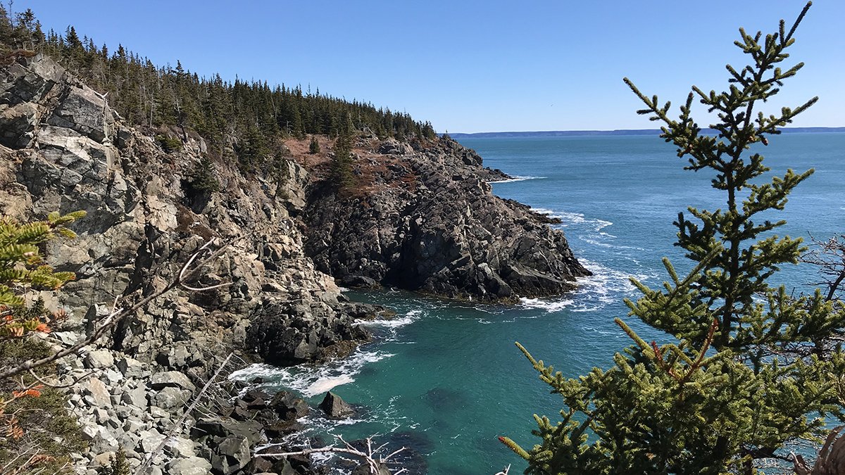
The precipitous headlands at Boot Head are a spectacular part of the Bold Coast.
Article and photos by Carey Kish
Maine’s Downeast coastline between Frenchman Bay and West Quoddy Head is a magnificent and sparsely populated landscape of broad peninsulas, wide bays, towering cliffs, spruce-studded islands, high tides and crashing surf. The scenic beauty and rural character of the aptly named Bold Coast, the easternmost terra firma in the United States, easily rivals that of its wildly popular neighbor on Mount Desert Island, Acadia National Park.
Recreational opportunities abound along the Bold Coast, especially for hikers, thanks to the extraordinary conservation work of many local, regional and national organizations and a host of state and federal agencies. With a mind-boggling array of land trust preserves, public lands and parks and wildlife refuges with many miles of meandering trails, paths and byways, there’s enough for many delightful hours and days of healthy adventuring on foot.
This summer and fall, when throngs of pent-up, post-pandemic visitors are turning south onto MDI to see and hike Acadia, continue eastward into the Bold Coast country for some day hiking experiences you won’t soon forget. Here are a handful of good ones to get you started.
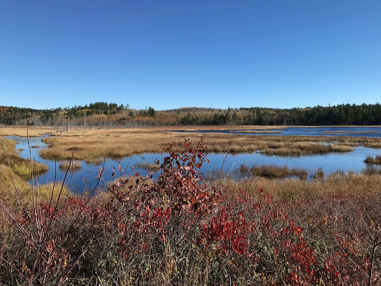
Schoodic Bog Preserve in Sullivan, Maine.
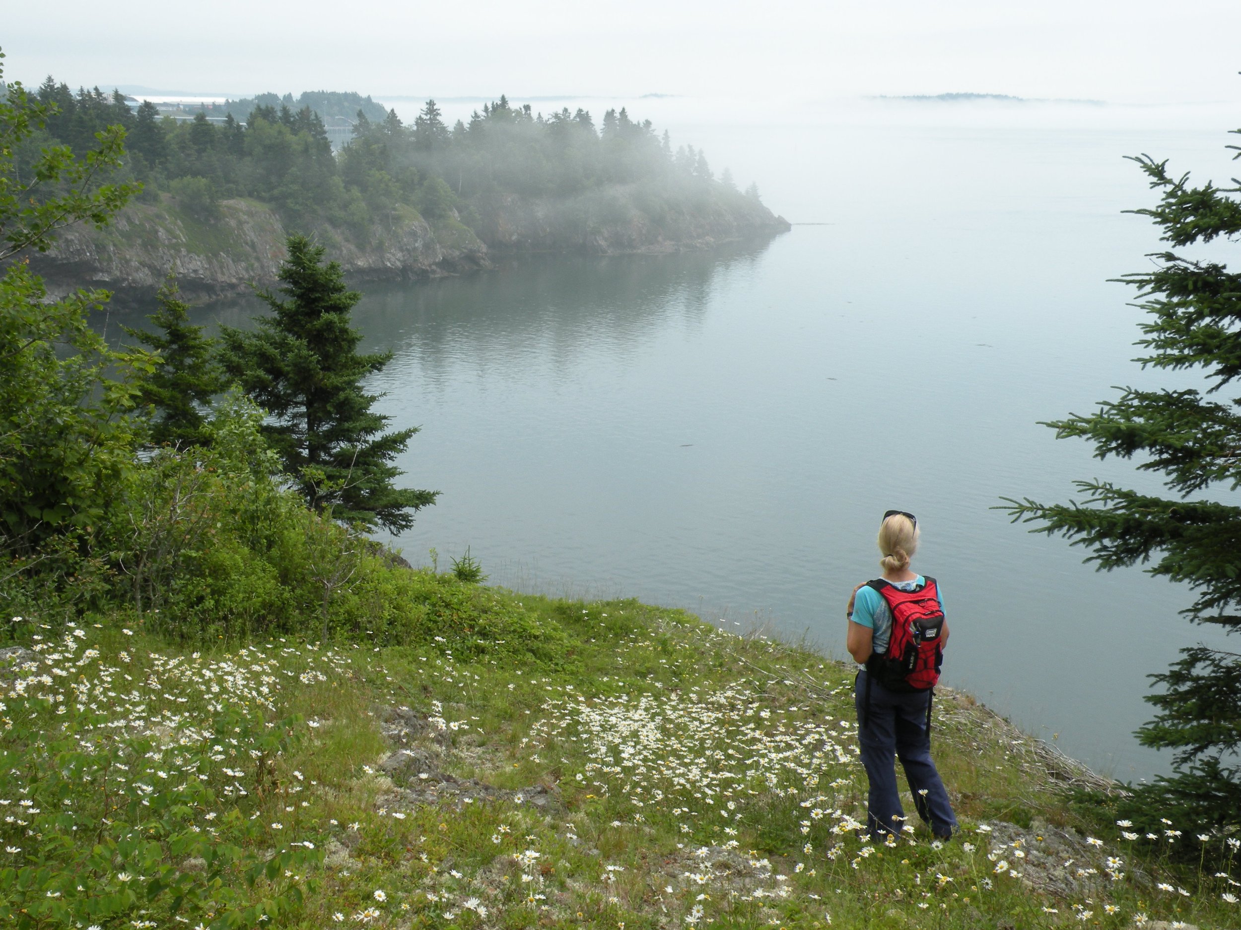
Boot Head Preserve, Lubec

A hiker enjoys the view toward Jim Head at Boot Head Preserve.
At Boot Head, Maine Coast Heritage Trust has protected an amazing stretch of Maine’s Bold Coast, from Boot Cove around the namesake headland across to Jim’s Head which, together with the abutting Hamilton Cove Preserve, totals 2,000 contiguous acres, total 2,000 contiguous acres. At Boot Head, hikers can enjoy a 2½-mile lollipop loop that climbs over the headland, visits the cobble beaches at Boot Cove and Brook Cove and skirts an interesting peat bog. Several waysides en route offer sweeping views across Grand Manan Channel to the great cliffs of Grand Manan Island.
Devil’s Head Conservation Area, Calais
The Devil’s Head trail offers up close views of the St. Croix River and St. Croix Island.
Owned by the City of Calais, this 318-acre preserve protects the dramatic namesake granite headland as well as cobble beaches and upland forests along the St. Croix River. Devil’s Head Trail ascends this escarpment, where several good views across the river into New Brunswick, Canada are possible. Devil’s Head, a variant of D’Orville’s Head, is named for Sieur d’Orville, who was among the original settlers on St. Croix Island; established in 1604, it was the first French settlement in the North America. Add the Shoreline Bluffs Trail for a nice 2½-mile loop hike.

Lobster trap washed ashore on the pink granite of Great Wass Island.
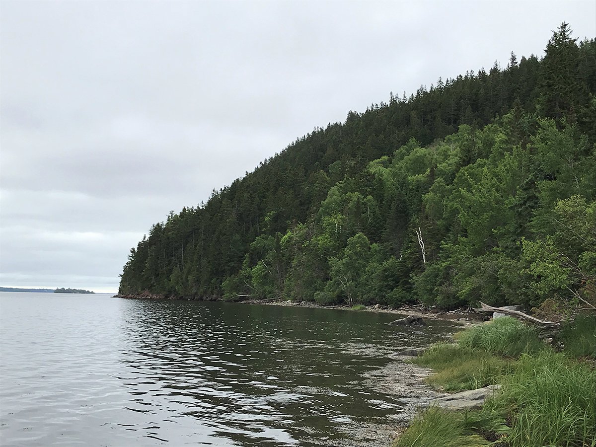
Great Wass Island, Beals
At Great Wass Island, you’ll amble through jack pine forests and pretty peatlands on the way to and from a spectacular chunk of waterfront protected by The Nature Conservancy’s 1,576-acre Great Wass Island Preserve. Bounded by Eastern Bay and Western Bay, the island projects farther out to sea than any other land mass in Downeast Maine. The Little Cape Point Trail leads out to Cape Cove and the namesake point, and from here it’s a wonderful marked but trailless scramble to Mud Hole Point and the Mud Hole Trail back to Black Duck Cove Road.
Machias River Preserve, Machias

Hiker takes in view of Munsons Pitch on Machias River, Heritage Trail.
The largest of Downeast Coastal Conservancy’s conservation holdings, this 917-acre parcel protects four miles along the wild and free Machias River on its 76-mile source-to-sea journey from Fifth Machias Lake to Machias Bay. More than five miles of trails allow for several loop possibilities. Hike the Heritage Trail for three lovely miles along the pristine big river, renowned for its Atlantic salmon fishery, passing the roaring rapids at Munson’s Pitch en route. Finish the 4½-mile circuit on a section of the Down East Sunrise Trail, a converted rail-to-trail.
Schoodic Bog Preserve, Sullivan

Schoodic Mountain as seen from a bench on the Schoodic Bog Trail.
Protecting an ecologically rich bog, this 500-acre preserve is a key link in an extraordinary contiguous corridor of conservation lands protected by Frenchman Bay Conservancy that ranges from US Route 1 to Donnell Pond Public Land. Combine the Schoodic Bog Trail, a portion of the Down East Sunrise Trail and the Schoodic Connector Trail for a terrific four-mile ramble. Semi-open ledges and the multi-use railto- trail yield great views of the craggy south face of Schoodic Mountain on the circuit around the 150-acre bog and its active beaver lodges.
Hiker looks at Ship Point from Schooner Trail, Shackford Head.
Shackford Head State Park, Eastport
The impressive bluffs of Shackford Head are a wild and scenic jewel located in sight of Eastport, the easternmost city in the United States. Bounded by Cobscook Bay to the west and Broad Cove to the east, the rugged 90-acre peninsula was the proposed site of an oil refinery in the 1970s, but after that effort was abandoned, Shackford Head State Park was established in its place in 1989. Seven trails totaling three miles of hiking reward hikers with a grand tour of natural highlights, including Schooner Overlook, Ship Point and Shackford Head Overlook.
Tunk Mountain, T10 SD

Hiker enjoys view from ledges on Tunk Mountain.
Tunk Mountain rises to a modest 1,157 feet but offers trampers incredible panoramic vistas of the wild and wooded Downeast landscape from its extensive open ledges. Part of the 15,000-acre Donnell Pond Public Land under the care of the Maine Bureau of Parks and Lands, a hike at Tunk features not only great mountaintop views but three “hidden” tarns, scenic beauties known as Salmon Pond, Mud Pond and Little Long Pond, found along a nice side loop. Begin and end at the Blackwoods Scenic Byway (Maine Highway 182) for a fine five-mile trek.
Resources for Downeast hiking beyond Acadia State Park and Mount Desert Island
Day hiking essentials
Map, compass, cell phone
Headlamp and spare batteries
Sun and insect protection
First aid kit and toilet kit
Pocket knife
Lighter or matches
Garbage bag as an emergency shelter
Ample food
Ample water
Suitable rainproof and warm clothing
Leave No Trace
Plan Ahead and Prepare
Travel and Camp on Durable Surfaces
Dispose of Waste Properly
Leave What You Find
Minimize Campfire Impacts
Respect Wildlife
Be Considerate of Others
(Source: lnt.org)

Panorama from the trail at Great Wass Island between Little Cape Point and Mud Hole Point.
Downeast park conservancies and land trusts
Devil’s Head Conservation Area (City of Calais), mainetrailfinder.com
Donnell Pond Public Land, parksandlands.com
Downeast Coastal Conservancy, downeastcoastalconservancy.org
Frenchman Bay Conservancy, frenchmanbay.org
Maine Coast Heritage Trust, mcht.org
Shackford Head State Park, parksandlands.com
The Nature Conservancy (Maine Field Office), nature.org