

A monumental adventure
Exploring the wild, scenic Katahdin Woods & Waters National Monument
The deep woods and pristine waters of the Monument have attracted visitors of all kinds for several thousand years, from the native Wabanaki people to loggers, scientists, artists and explorers, to today’s outdoor adventurers. Photo: Andrew Hansen
By Carey Kish
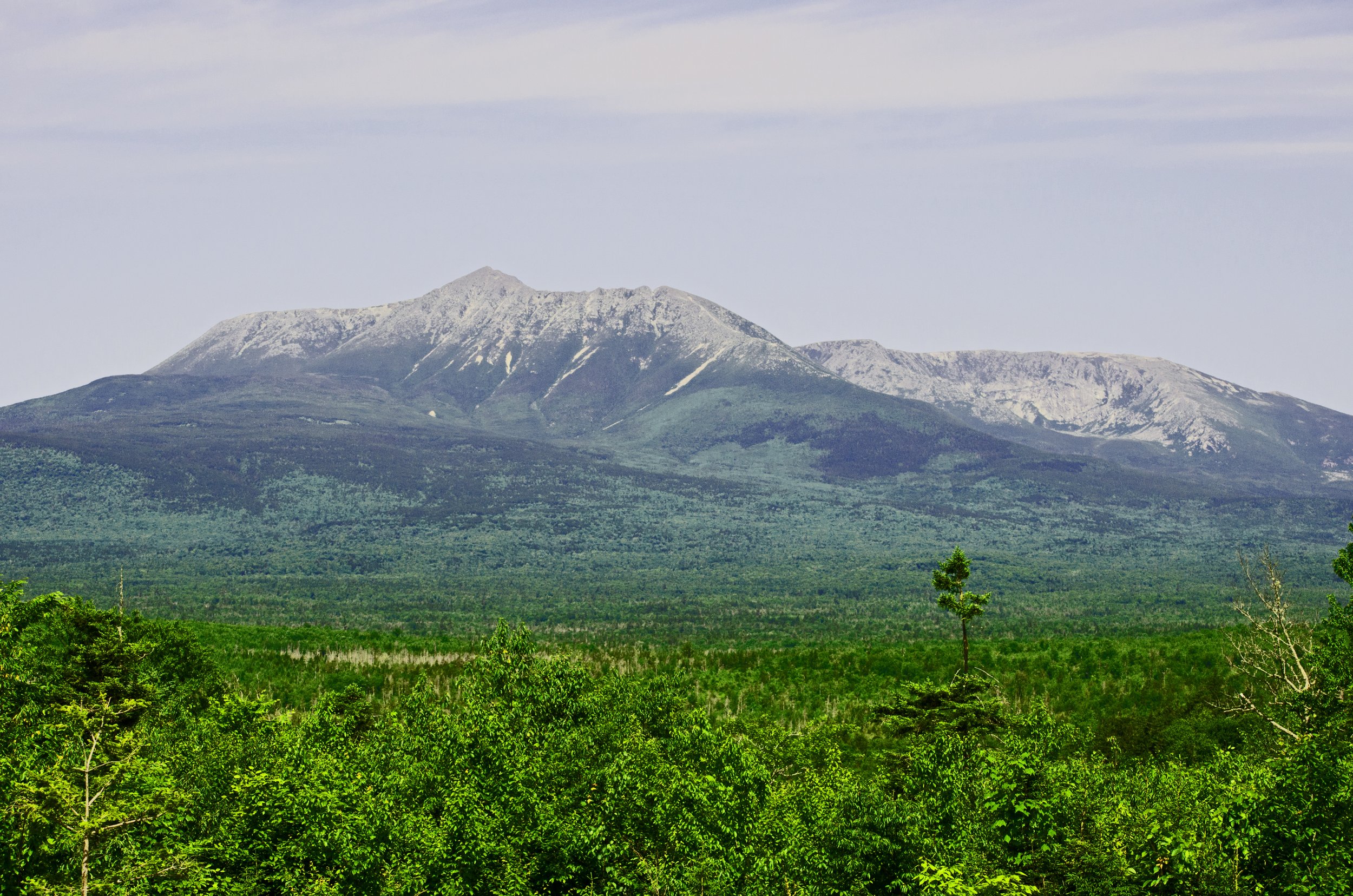
CRAGGY MOUNTAIN PEAKS, deep woods, free-flowing rivers and streams and a bounty of wildlife characterize the new Katahdin Woods and Waters National Monument, which preserves an 87,500-acre area long recognized for its ecological, recreational and cultural significance. Located immediately east of Baxter State Park, the Monument is nearly twice the size of Acadia National Park on the coast. It is the latest addition to a diverse matrix of public and private conservation lands totaling several million acres in Maine’s North Woods that range southwest across the 100-Mile Wilderness to Moosehead Lake and west to the Canadian border.
Using the authority granted by the Antiquities Act of 1906, President Barack Obama established Katahdin Woods and Waters National Monument with a proclamation on August 24, 2016. The lands that comprise the new monument were assembled by the private non-profit, Elliotsville Plantation, Inc (EPI). between 2001 and 2014 and then donated to the federal government. Along with the land, the EPI foundation donated $20 million to establish an endowment for the Monument and pledged to raise an additional $20 million in the future.
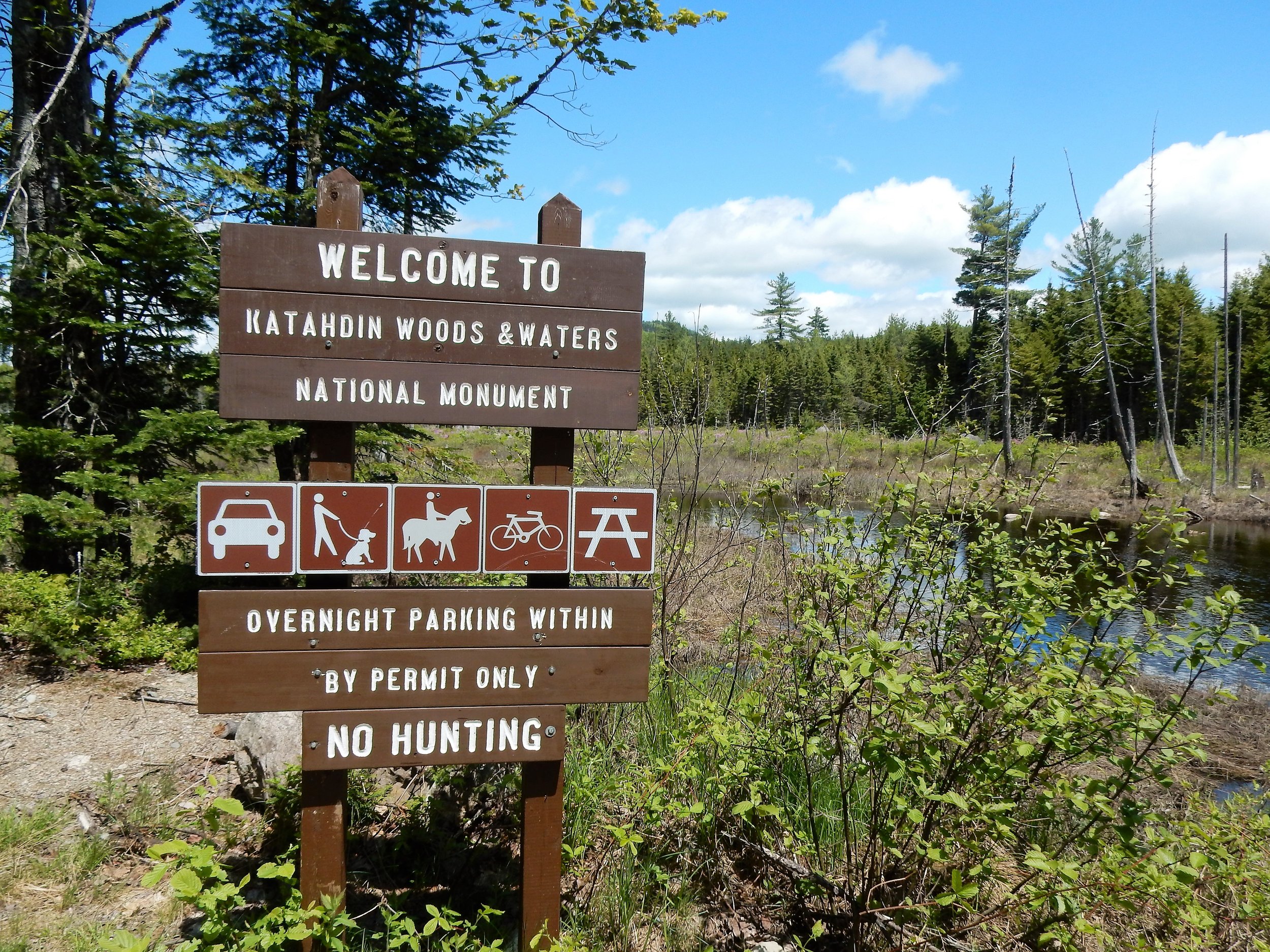
Photo: Carey Kish
The National Park Service manages the new park unit and is currently working through a three-year public process to develop a management plan that will guide future activities on the land, where there is currently little infrastructure. The length and breadth of Katahdin Woods and Waters National Monument are currently open for a wide variety of recreational activities, and a visit presents a unique opportunity to experience this new parkland in its infancy, a wildly raw and virtually undeveloped state.
A scenic stretch of the East Branch of the Penobscot River features a long series of waterfalls and rapids, while the bouldery Wassataquoik Stream flows through the southern half of the heavily forested region to empty into the East Branch, across from the historic Lunksoos Camps. Seven relatively low but rugged mountains dot the landscape, and three peaks feature foot trails that lead to spectacular views of Katahdin and the mountainous skyline of Baxter immediately to the west. The mostly open summit of Deasey Mountain, topped with a groundhouse firetower cab, is the highest point at 1,942 feet.
Monument visitors can enjoy everything from hiking and backpacking, camping, canoeing and kayaking, mountain biking and fishing to bird and wildlife-watching, horseback riding, plenty of good old seat-of-the-pants sightseeing and, in winter, cross-country skiing, snowshoeing and fat tire biking. A portion of the land is also open to hunting and snowmobiling. The International Appalachian Trail begins near Barnard Mountain and traces a 30-mile route through the Monument on its long journey across Maine, New Brunswick and Quebec to its North American terminus at Crow Head, Newfoundland.
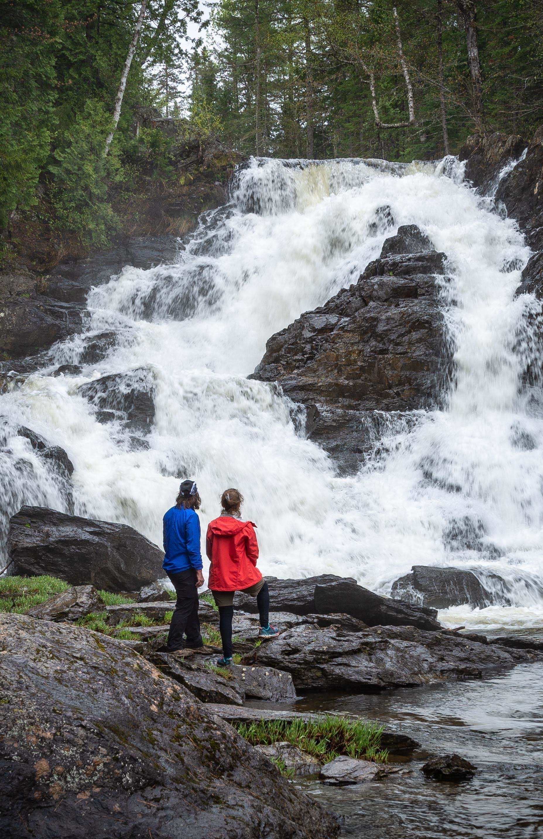
Visitors with varied outdoor interests and abilities will enjoy the beauty and wonder of Maine’s new national monument and the surrounding area, such as this scenic spot at Shin Falls. Photo: Bill Brooke
Far from the beaten path
Visitors can access Katahdin Woods and Waters National Monument from I-95 at Exit 244 in Medway or Exit 264 in Sherman, and then a series of state, local and, finally, private active gravel logging roads (open to the public but please go slowly, keep right and yield to trucks). Millinocket, East Millinocket, Medway and Patten are the primary gateway communities, greeting visitors with a full range of goods and services.
The Monument is a remote and undeveloped area, so for a safe and enjoyable trip, visitors are advised to “know before you go” by checking in for information and orientation at either of the two National Park Service welcome centers, one in downtown Millinocket (open daily Memorial Day through Columbus Day) and the other at the Patten Lumberman’s Museum in Patten (Friday through Sunday from Memorial Day through June, then Tuesday through Sunday until Columbus Day). Most local businesses will happily offer advice and tips for travelers as well.
The gravel-surfaced Katahdin Loop Road traces a 17-mile route through the southern section of the Monument and offers first-time visitors a fine look around by touching on the most popular hikes, walks, and viewpoints available at this time. There is limited drive-in camping, but plenty of camping and lodging options can be found outside the boundaries. A fire permit from the Maine Forest Service is required for all campsites, and a parking permit is necessary for vehicles left overnight at trailheads.
Monumental history of people and events
Katahdin Woods and Waters National Monument is home to a storied natural and cultural landscape that will enrich your experience of this special place and provide plenty to ponder while poking around.
The glaciers of eons ago heavily sculpted this area before retreating 12,000 years ago, leaving behind their landmark kettles, moraines, eskers, erratics and glacial till. The underlying bedrock is up to 500 million years old, and the exposed rock of this pre-Cambrian period can be seen at Grand Pitch on the East Branch of the Penobscot River.
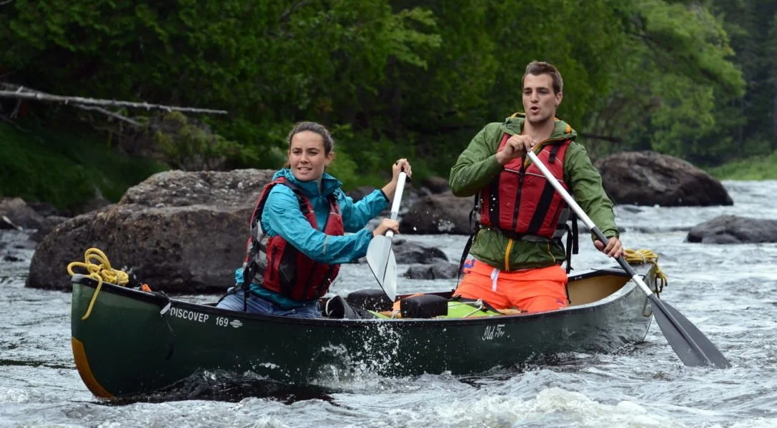
The East Branch of the Penobscot River challenges paddlers with a long series of Class I-III rapids over the same route Henry David Thoreau canoed in 1857. Photo: Dave Conley
Long before European settlers on the Maine coast ventured north into the expansive forests to reap its bounty of wood, the Wabanaki—the “people of the dawn land”—traveled through these woods and waters to hunt and fish. Today’s Penobscot Indians still consider the land a sacred part of their native traditions. Penobscot guides accompanied renowned essayist and philosopher Henry David Thoreau, and the Thoreau-Wabanaki Trail commemorates these journeys by tracing Thoreau’s routes through the region, including his passage down the East Branch in 1857.
The 1840s until the early 1920s marked the heyday of the logging industry here, when hardy crews of men toiled through the winter months cutting pulpwood and pine logs before driving them off with the spring meltwater to the mills far downstream. Two wilderness farms on the edge of civilization were established in 1830s, the Hunt Farm by William Hunt and Lunksoos Camp by Hiram Dacey. These farms not only helped feed the ravenous appetites at the many logging camps but over time also served as a base for trampers, sportsmen, scientists, artists, authors, conservationists and others interested in exploring the Katahdin region and climbing its mountains.
Other noted early visitors to the area include ornithologist, naturalist and painter John James Audubon in 1837, as well as Frederic Church of the Hudson River School of American landscape painters, who made five visits in the 1850s. Charles Jackson visited in 1837 during a survey of the state of Maine, while geologist Charles Hitchcock traveled through while conducting research in 1861.
Until the 20th century, the preferred route for scaling Katahdin was from the east at the East Branch of the Penobscot River, via the Keep Path established by the Rev. Marcus Keep in 1848. Hikers would stay at Hunt Farm then head up the Wassataquoik Stream valley, cross over to Katahdin Lake and finally proceed on to the mountain. William Sewall guided Theodore Roosevelt along this route in 1879, while in 1920, Percival Baxter, before he was governor, used the Keep Path to climb the mountain he would soon come to protect (along with 200,000 additional acres of Maine wildlands). In 1939, 13-year old Donn Fendler emerged from the Wassataquoik Stream woods opposite Lunksoos Camp after nine harrowing days utterly lost in the Katahdin wilderness.
Many ways to experience Katahdin Woods & Waters National Monument
Whether by car, by foot, by bike or by boat, people of every ability can enjoy the Monument—in as much or as little time as they plan to visit.
On the drive into the southern section of the Monument via Swift Brook Road from Route 11 in Stacyville, Whetstone Falls (outside the Monument) offers your first good look at the pristine East Branch of the Penobscot River. Ahead, at the Sandbank Stream Picnic and Camping Area, you will find an information kiosk, several campsites, picnic tables and toilet—as well as a short streamside nature trail. Katahdin Loop Road splits two miles beyond; turn left to drive it through in the recommended clockwise direction. Note: from after Mile 4 to about Mile 6 and from Mile 9 almost to Mile 12, the Loop Road shares the way with a two-way logging road, so drive slowly, keep right and yield to trucks.
The Lynx Pond Nature Walk may be found at Mile 2; it leads to a boardwalk on the pond. Between Miles 6 and 7 is a scenic overlook with picnic tables, several interpretive panels and an amazing view of Katahdin and the woods and mountains of the 100-Mile Wilderness to the south. Between Miles 7 and 10 are a host of lookouts with the always spectacular Katahdin vista.

National Park Service welcome centers in Millinocket and Patten offer important information and orientation for a safe and enjoyable visit to the Monument. Photo: Carey Kish
Find trailhead parking for Barnard Mountain near Mile 12. Allow a couple hours for this moderate day hike via the IAT and a side trail to the summit ledges and grand views of Katahdin Lake and the Katahdin massif. Ambitious hikers can hike into the heart of the Monument via the IAT along a wonderful route that crosses Wassataquoik Stream and climbs over Deasey Mountains and Lunksoos Mountain before reaching the old Wassataquoik Tote Road in the valley of the East Branch. Four designated lean-tos en route offer shelter, and there are a handful of riverside tent sites.
Soon after Mile 15, Wassataquoik Road departs north and in 2.5 miles reaches parking for Orin Falls Trail. This lovely path follows a glacial esker and then Wassataquoik Stream to the namesake falls 3 miles out. (Both Barnard Mountain trailhead and Orin Falls Road can also be reached directly by bearing right at the Katahdin Loop Road split soon after Sandbank Stream).
Mountain biking is also a nice way to see this part of the Monument, via not only Katahdin Loop Road but many miles of old gravel logging roads. And remember that whatever trails you can hike you can also mountain bike. Reach the northern section of the Monument via Route 159 from Patten and Grand Lake Road from Shin Pond.
Experienced canoeists and kayakers can enjoy the thrill of a multi-day paddle down the East Branch of the Penobscot River, which features multiple Class I-III rapids and falls. Or, in early season, put in on the nearby Seboeis River for a pleasant Class I-II run to join the East Branch downstream. Local outfitters provide canoes, gear and guides for less experienced river adventurers.
From the Monument’s north gate and parking four miles in via Messer Road, take a pleasant hike to Haskell Hut, a classic log cabin (day use in summer, overnight use in winter) in a tranquil setting overlooking Haskell Deadwater, then move on to Haskell Rock Pitch and perhaps even Grand Pitch on the rough-and-tumble East Branch. Pack a fly rod and wet a line for brook trout, salmon and smallmouth bass. And always keep an eye out for moose and other wildlife that make this wild place their home.
Come wintertime, the northern end of the Monument hosts the action. Sixteen miles of machine-groomed trails offer untold opportunities for fun and exercise for cross-country skiers and snowshoers. Cozy up for a night with a warm bunk near the woodstove and plenty of camaraderie at the Haskell or Big Spring community huts (reservations required).
The outdoor enjoyment possibilities are seemingly limitless in the beautiful new and unspoiled Monument, and this year is the perfect time for a visit.

Mountain bikers can enjoy many miles of scenic trails, tote roads and gravel roads in the Monument. Photo: Bill Brooke
